At the time of the Enclosure in 1779, Rushden was a farming community. Suppliers were given licences to sell goods, and many grew their own vegetables, baked bread, and kept a few hens. Those who couldn't provide for themselves were given parish relief through the Poor Law. If they were born elsewhere the Overseers of parish might try to send them back to the parish where they were born, and would seek a court order to remove them.
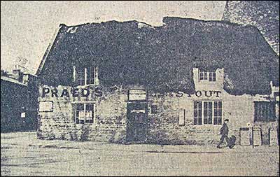
In 1841 Rushden was still a mainly agriculutral village. It had grown up around the road, this being a main way from London to the North. It also followed for the most part, the brook or stream that ran through from the south, almost following the road of today (but now mostly culverted), through Rushden Hall Park, to Duck Street, and out through Spencer Park, and winding down to the river Nene at Ditchford.
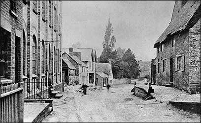
So Duck Street was the main thoroughfare, and sometime suffered floods. Development began with the shoetrade mechanisation of the 1850s, now needing factories. This brought in workers from the surrounding villages, so rapidly increasing the need to develop.
|
A proposed sale May 11th 1882. This photocopy of the map is all we have:
|
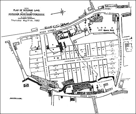 |
The road running down from the top right is now called College Street.
This 1882 plan shows it as Higgins Lane, and it was to be widened.
The 2 buildings at the top - are Wilmotts shop and the Rose & Crown.
Several plots remained unsold as the lower part along the brook is where
John Cave built a new factory in 1904/5 to replace one burned down in
the great fire of 1901. He also bought the large property Lot A (top right)
|
The 1880s saw great changes; take a look at the sales that took place in the next few years. A need had come for new businesses to support the growing population and a new street was planned. The plan (right) shows a 'proposed new street' marked across the centre, but this was not built. Instead the High Street was developed. Some land formerly Marriotts farm was available, and was higher than the valley of Duck Street.
The High Street was ceated on land that had originally belonged to farms. The most northern end of the town was Mason's Farm, John Clark's Farm, Marriott's Farm, Laughton's, Denton's Farm was further along High Street, and Smith's Farm in High Street South. More farms were in Bedford Road, Wymington Road with a windmill close to the village boundary, Newton Road, and Wellingborough Road, where another windmill stood close by.
Development was apace in the 1880s, and 1890s. The Denton family had been shoemaking, and John Cave & Sons had extended their factory following a fire in 1877, and a second extension in 1898 with six shops on High Street, Marriott's were now much involved in building work, and had moved to land further north, and the old farmhouse was now a school. A nursery was established by the rural postman and his son, and several of the farm barns were being put to other uses; the fire brigade keeping the fire hose and cart in one, Doctor Freeman had another, and Phillips opened their drapery in another.
Wellingborough News, 22nd April 1887, transcribed by Kay Collins
LAWTON'S ESTATE—We hear that the land in this village, known as Lawton's Estate, has been purchased by the Rock Freehold Land Society.
|
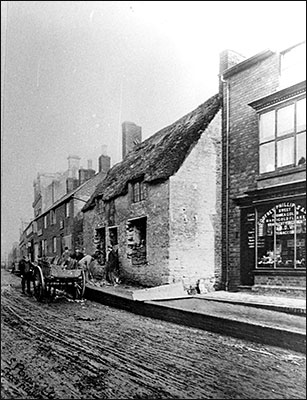
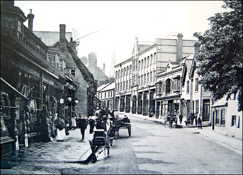
High Street was not numbered until about 1895/8, so placing some buildings can be difficult without maps, like this one, that have names added. This photograph comes dated as 1895, and showing a tobacconist shop identified as being Henry Sharpe. He is known from trade directories have been in High Street between 1890 and 1894, but is not listed in 1898.
| Captioned 'c1895 Henry Sharpe's tobacconist.' (no 90) Harry Sharpe was also a musical instrument maker - in 1900 he was bankrupt.
The buildings were not numbered until about 1898.
The two thatched cottages are being demolished. (92 & 94)
Note the footpath is higher than the road, making easy loading of the reclaimed brick and stone from the window openings into the cart on what appears to be a muddy road.
|
|
 |
|
 |
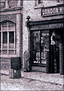
Arthur Ashby had traded here at 71 High Street from 1889 before building a new
shop at 80 High Street in 1895. W Howard hairdresser/tobacconist at 73 c1905/6
|
 |
|
|
| In 1898 J Wooding & Son, confectioner was at 62 High Street, and the Misses Mobbs took over the shop in 1909. They remained here until 1921 when they moved to 35 High Street, taking over Hewitt's stationery shop. Lipton's grocery store traded here from 1921. |
| At 64 High Street John Louvre opened a drapery. In 1920 this was J H York, and in 1928 T H Walton took over and called the shop The Louvre, presumably after the first trader here. It traded until at least 1965. |
| Star Tea Co. Ltd opened at 66 High Street and remained there until the 1960s. |
|
 |
|
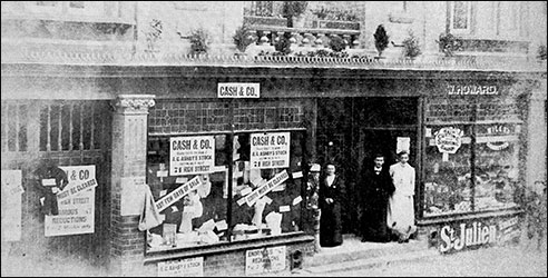
c1894 Stephen Higgins drapery
|
Stephen Higgins is listed in the Kelly's directory for 1894 and by 1897 it was Beddall's and in 1898 Baird's .......
|
|
|
 |
|
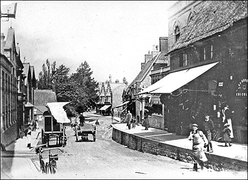
c1898 with the enlarged Cave's factory, now with shops below.
|
The shops were dotted in amongst the houses until gradually the houses were also converted into shops.
Trade Directories also provide much information of the expansion.
Many of those early buildings still survive, and although the ground floor frontages have changed, a look upwards shows their origins.
|