|
1
|
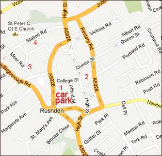
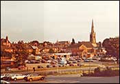
Start the walk at the Duck Street car park (west of Duck Street) and head north following the flow of traffic.
Pass the pedestrian lights and after a few yards turn left into Fitzwilliam Street.
|
 |
|
2
|
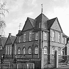
After a short walk up Fitzwilliam Street, past the the old Primitive Methodist Church, turn right into Moor Road and walk along the footpath on the right-hand side of the road. |
 |
|
3
|
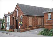
A blue painted building on the corner of Moor Road and Station Road was the ARP depot, first aid station and mortuary. |
We have no picture.
Please can you help?
|
|
4
|
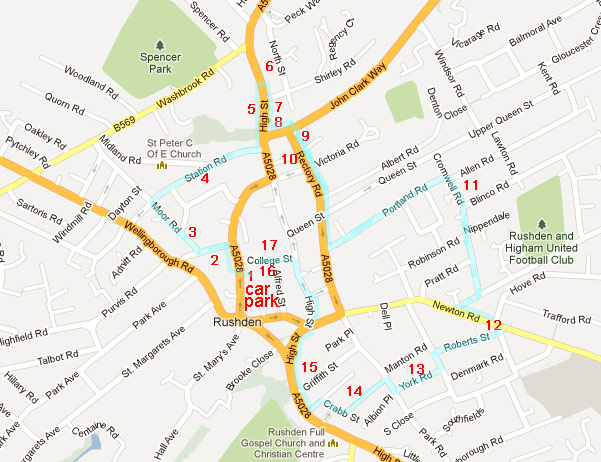
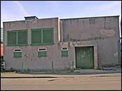
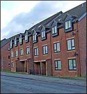
 Turn right down Station Road. Pass "Totector Court" on your right. Beyond the next block of houses, there is a footpath to Carnegie Street, and below this stood: Turn right down Station Road. Pass "Totector Court" on your right. Beyond the next block of houses, there is a footpath to Carnegie Street, and below this stood:
The "Gas Meter" Factory which did military work.
[now demolished, stood here - photo 2006]
|
 |
|
5
|
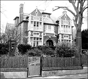
Continue to the High Street, turn left and walk a little way past the Asda superstore. Across the road there were three buildings close together.
Left of the Jet garage was "The Shrubbery", a large Victorian house, which was first the Canadian, and then the US officers quarters. (Late called "Risdene" now demolished)
|
 |
|
6
|
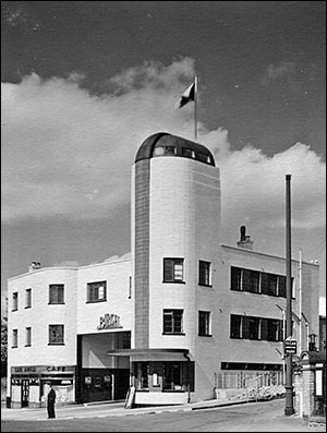
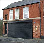
Right of the garage was Birch's bus depot (art deco style building), now a furniture store, where tyre re-moulding was carried out for the military.
Many service men and women would have begun their journey to join the forces from this bus depot, as it ran a regular service to London and all towns between.
|
 |
|
7
|
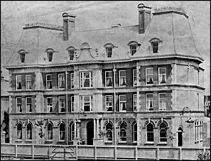
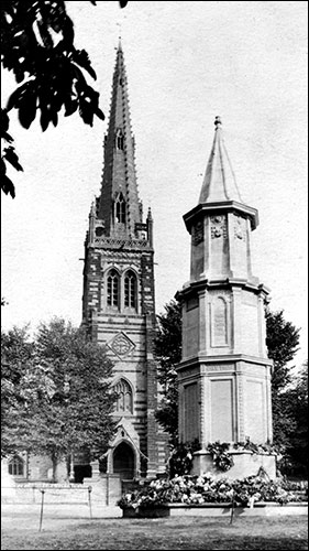
The "Queen Victoria Hotel" was built in 1899 in the style of a French chateau. It was bombed in October 1940, at the same time as Alfred Street School, and lost a tower at the south end (the right hand side of the building). It was later called the Rilton Hotel.
The building is now converted into luxury flats: Queen Victoria House, with an additional block built on the car park: Victoria Court.
|
 |
|
8
|
Cross the road and stand on the Queen Victoria House corner. Look along the High Street. You can see the route of the bombs that damaged The Queen Victoria Hotel, Stonehurst (now the New Factory Shop), a fish and chip shop on the Duck Street corner (now part of Weatherspoons 'The Railway'), and Alfred Street School and Cave's shoe factory beyond, in College Street. |
 |
|
9
|
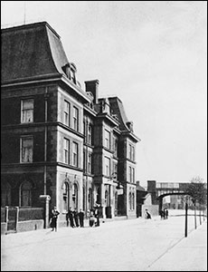
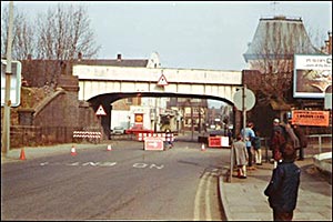 Walk back along the High Street 'under' the demolished railway bridge, and turn left to the old Railway Station. Many more men and women would have travelled from here to start their military service. Walk back along the High Street 'under' the demolished railway bridge, and turn left to the old Railway Station. Many more men and women would have travelled from here to start their military service.
|
 |
|
10
|
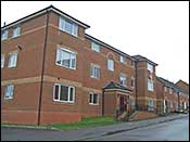
Turn right along Rectory Road.
The flats further on, on the right are built on the site of the "Stockade", the GI's detention centre.
Turn left up Portland Road. Turn right along Cromwell Road.
|
 |
|
11
|
The area on the left between Allen Road and Blinco Road, facing Lawton Road, was the site of the Covallen Engineering works which machined parts for tanks including tank turrets and track bogie wheels. They also reconditioned engineering machinery damaged in the raids on Coventry.
Turn right at the end and turn left into Newton Road. Walk along past Newton Road schools, cross the road and take the first right turn.
|
 |
|
12
|
Turn sharp right into Roberts Street.
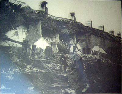
The newer houses (Police houses) on the right show where a bomb dropped on 19th November 1940 at about 11.30pm killing 4 adults and 1 child. It fell in the gardens between Roberts Street and Newton Road, demolishing rows of terraced houses in both streets. The blast from the bomb jammed the doors of the Fire Station in Newton Road so that they could not be opened; it also broke shop windows in the High Street.
|
 |
|
13
|
Turn left into Grove Road. Then right into York Road.
A canister of flares (used to illuminate a target) pierced the roof of the bottom house. It set fire to the house and fractured a gas pipe. Escaping gas killed 2 people.
|
 |
|
14
|
Turn right into Park Road and take the first left into Crabb Street.
A shop on the right on the second bend was the HQ of a Home Guard Unit.
[near this building]
|
 |
|
15
|
Turn right into High Street South past the flats on the right (built on the site of the Co-op grocery and butcher's shop). Cross the A6 and walk to the entrance to Hall Park.
In the early part of the war the Hussars were based in the park with their Bren gun carriers. Later there were Nissen huts in the car park for the GIs.
[we have no picture - please can you help?]
|
 |
|
16
|
Cross the road by the war memorial, walk past Tesco's Convenience store and turn left down Church Street then right into Alfred Street.
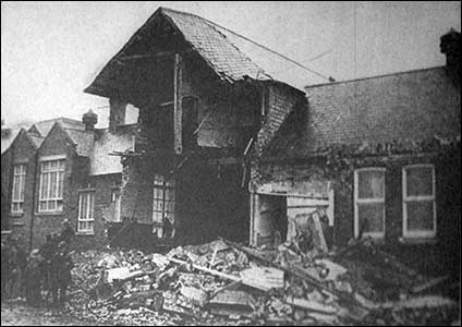
Alfred Street School was bombed mid-morning on 3rd October 1940. 4 adults and 7 children were killed and 40 people injured. The air raid shelter in the school playground was hit, luckily the air raid warning had not sounded and the shelter was empty.
|
 |
|
17
|
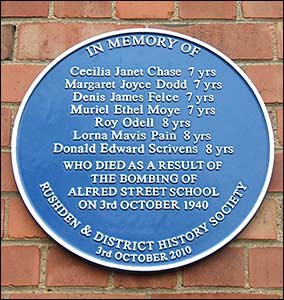
Turn left into College Street and walk down by the school where a recently placed 'blue plaque' remembers the bombing. Turn left again back to the car park at the bottom of the road (Duck Street). You may also go into the memorial garden.
Bombs from the same stick also damaged Cave's factory (now Wilkinsons) and killed 4 men.
|
 |