Click here to return to the main site entry page
Click here to return to the previous page
Courtesy of Alan Bathurst and Reg Redford, and Echo & Argus newsclips
Aerial Photographs

 Echo & Argus, 24th September 1954
One of the finest ever published, this aerial view of Rushden was secured a few days ago by an “Echo and Argus”
staff photographer. In the foreground are trees in the Hall Grounds, part of High Street South and Crabb Street. Wellingborough Road (left) and High Street South fork out like branches of a letter Y,
and to the right Park Road and Rectory Road are conspicuous.

The Rushden Echo and Argus, 21st September 1959

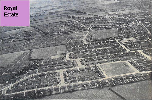
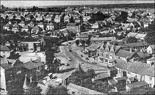
Popularly known as Rushden's "Royal' estate, the Upper Queen Street area is the newest development of council housing in the town and already the largest post-war sector.

From Balmoral Avenue in the foreground the picture looks across to the Town Sports Ground, where the football grandstand is easy to pick out, and the estates on either side of Newton Road, which threads towards the top left-hand corner.

The Baptist Sports Ground, with portions enclosed for tennis and bowls, is seen left of the new streets, from which an embryo road already connects, along by the Town Ground, with pre-war Hove Road.

The lane towards Chelveston crosses the picture just above the middle, and there is a glimpse of the road to Bedford (top right).

Aerial view of the 'Royal Estate'

1950s
This superb aerial view is dated 1950s. The road at the bottom is High Street South, the double long terraces across centre are Crabb Street and the single long terrace is Co-operative Row - only part of that survives today. Just above the top of Co-op Row stand the old and new Methodist Churches. The Parish Church spire is a quarter along from the left top of the view, and left of the church is the road junction near the War Memorial. Old South End School is bottom left, the road junction near centre base of view is Wymington Road.
The factory facing this junction was built in 1874 by William Green, shoe manufacturer. Extract of 'Top End'
1950s
These two 1950s aerial views were in the Evening Telegraph; we don't have the date, but in the 1980s.

Eavesdropping on Rushden! MORE Rushden rooftops — this time in an aerial picture dating back to the 1950s.
The shot was taken looking south over the town. In the bottom left-hand corner you can make out the old railway line serving Rushden and Higham with its bridge over the end of High Street. It is obvious that the picture was taken on a sunny day — the High Street shops all have their blinds down.
In addition to High Street, stretching away south through the town is the parallel Rectory Road, stretching into Park Road. Then in the distance you can make out the A6, snaking its way past what is now the rugby ground, heading towards the county boundary.
One thing becomes immediately apparent on studying the picture — just how many footwear factories the town has lost over the past 30 years. And many older Rushden residents will doubtless be able to name them all...

1950 Lightstrung area
This 1960s picture shows the junction of Duck Street, Church Street, Skinners Hill and St Mary's Avenue, now a roundabout. The building just below the three trees centre of picture is the Lightstrung garage, and behind the trees is the Adult School.
Ivy Cottage was demolished for road widening


Below: a similar view taken from scaffold.
late 1950s

College Street running diagonally - North side of the street:
Cave's Factory The 1940 Post Office Barclays Bank 1902 Post Office
College Street aerial view

In the 1960s or 70s before Ebenezer Terrace and John White's Newton Road factory were demolished, and before the Council Offices and the Library had the connecting foyer built.
P W Wills' bottom left, and the old Fire Station with tower towards top right.

Duck Street area
1984 College Street (left to top) into Duck Street - the large building left of centre was just completed for Budgen's. The car park (not finished) was formerly part of John Cave's garden that he had turned over to a sports ground for his employees. Top left: The Ritz cinema and Alfred Street Schools.

A 1988 view over central Rushden
1988 - at the top left of centre is Hall Park - bottom left corner is the workshops of Robert Marriott builders (now Asda 2010)
Aerial view over Rushden in 1991
1991 - shows Hall Park left, towards top right Budgen's store is marked, and Duck Street. Almost centre is the Parish Church.

see also John Street and the Town in 1984


Click here to return to the main index of features
Click here to return to the History index
Click here to e-mail us