|
||||||||||||||||||||||||||||||||||||||||||||||||||||||||||||||||||||||||||||||||||||||||||||||||||||||||||||
| Higham Ferrers Survey, by P Brown in 1965 |
||||||||||||||||||||||||||||||||||||||||||||||||||||||||||||||||||||||||||||||||||||||||||||||||||||||||||||
|
A Survey of Higham Ferrers - August 1965
|
||||||||||||||||||||||||||||||||||||||||||||||||||||||||||||||||||||||||||||||||||||||||||||||||||||||||||||
|
This survey has been passed to us by the author who was aged 15 when he completed this project. |
||||||||||||||||||||||||||||||||||||||||||||||||||||||||||||||||||||||||||||||||||||||||||||||||||||||||||||
|
||||||||||||||||||||||||||||||||||||||||||||||||||||||||||||||||||||||||||||||||||||||||||||||||||||||||||||
|
A Saxon Burgh
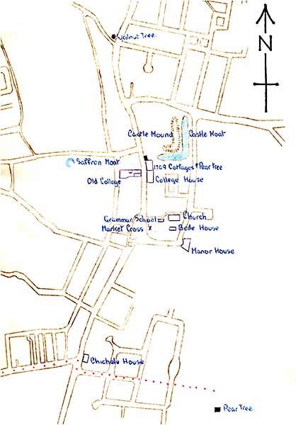
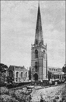
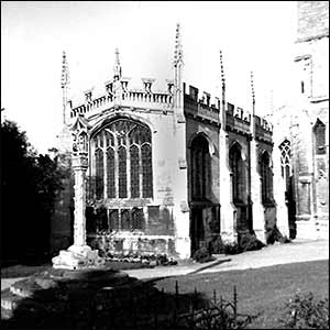
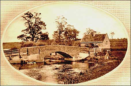
Higham Ferrers is both one of the oldest and smallest boroughs in Northamptonshire. As a Saxon burgh Hecham had strategic importance because of its high and commanding position above a crossing of the Nene. Being the centre of much commerce it had rough fortifications and these were later developed when William the Conqueror handed the town to William Peverel, an able general, who crowned the hill top with a castle. Although there may have been two castles at different times, the accent is on peaceful progress with hunting as one of the chief diversions, deer being plentiful in the adjacent forest. The Ferrers family succeeded to the heritage and the freeing of serfs and their families by William de Ferrers in 1251 High Ham took on the name of Ferrers and the dignity of a seignorial borough. In or about 1371 was born Henry Chichele whose father, a draper, was several times mayor of the borough. Henry Chichele became Archbishop of Canterbury in 1413, holding the office for thirty years. The Archbishop, a “much enduring , solid and competent” man, was buried in Canterbury Cathedral but for Higham Ferrers people the precious memorials are in the town of his birth where out of his affection for the old place he founded a college and a Bede House. The borough’s first royal charter has been lost but several others have been preserved and the oldest is that of Philip and Mary, granted in 1556. At that time Higham was granted the right to send one member to Parliament and this right was enjoyed until the Reform Act of 1832 In the Lancastrian era Higham Ferrers was one of the headquarters for the administration of the Duchy of Lancaster. The manor and some of the farmland still belong to the Monarch in the right of the Duchy but other esta The conservative policy of its landowners is the reason why Higham Ferrers, despite its distinctions and privileges, has made but little material growth leaving the adjoining town of Some institutions, it is true, have faded or changed and the chief loss is that of the markets and fairs. Through several centuries the town took pride in and profit from its markets and there was a time when as many as seven fairs would be held within a year. Cattle and general markets have been held on the market square within living memory of the previous generation and inside the same span of time In the old sense, the fair is extinct but in happy compensation the town has developed and made locally famous an annual Market Day. On very special days there will be an invitation to the Town Hall and a proud review of th beautifully illuminated Charters, together with the Rolls of the Court of Burgesses. The Rolls are packed with history and date back to 1275. They show that of sixty persons involved in the business of the Hundred court on
|
||||||||||||||||||||||||||||||||||||||||||||||||||||||||||||||||||||||||||||||||||||||||||||||||||||||||||||
|
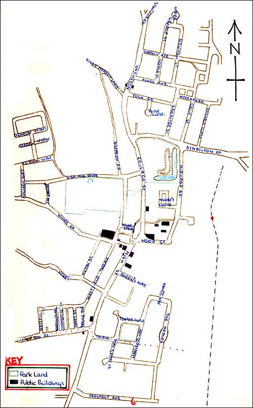
Industrial Development & Distribution Higham probably grew as a leather tanning town due to the abundance in the area of oak trees from which tanning materials were obtained. There are now many branches of the leather, boot and shoe industry and also of the plastics and rubber industry existing in Higham Ferrers. The boot and shoe industry has not expanded much in the last few years. Building firms and service station owners have seen a marginal increase in assets. Gould, the manufacturers of pet foods and accommodation have been trading in the current location for a little over a year. Previously the factory had belonged to the Hector Leather Company. |
||||||||||||||||||||||||||||||||||||||||||||||||||||||||||||||||||||||||||||||||||||||||||||||||||||||||||||
|
||||||||||||||||||||||||||||||||||||||||||||||||||||||||||||||||||||||||||||||||||||||||||||||||||||||||||||
|
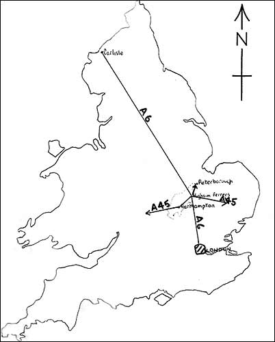
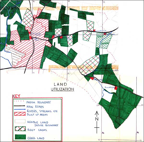
The three fields in the southern most tip of the boundary between grids 982 and 988, south of the 670 east west line, were bought when Chelveston air base was built. Landing lights were erected in these fields which otherwise contained rough scrub like vegetation.
|
||||||||||||||||||||||||||||||||||||||||||||||||||||||||||||||||||||||||||||||||||||||||||||||||||||||||||||
|
||||||||||||||||||||||||||||||||||||||||||||||||||||||||||||||||||||||||||||||||||||||||||||||||||||||||||||
|
||||||||||||||||||||||||||||||||||||||||||||||||||||||||||||||||||||||||||||||||||||||||||||||||||||||||||||
|
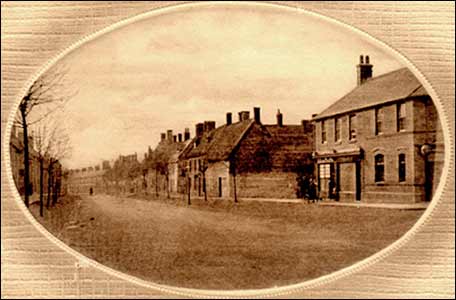
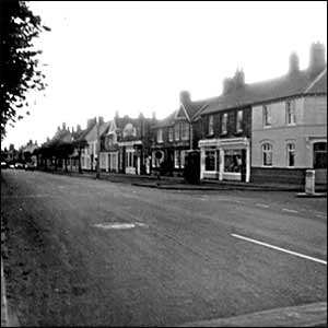
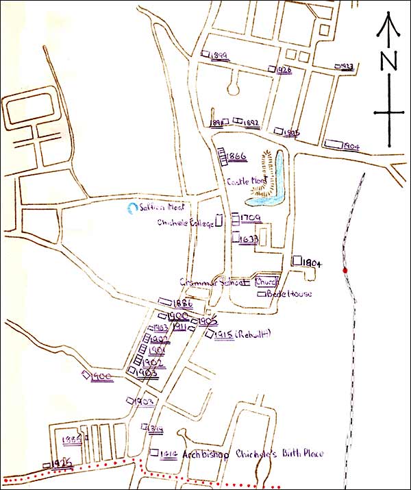
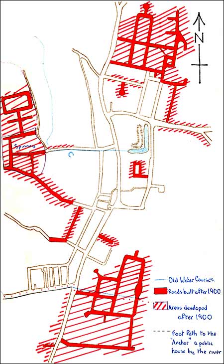
Extension of the Borough since 1900
|
||||||||||||||||||||||||||||||||||||||||||||||||||||||||||||||||||||||||||||||||||||||||||||||||||||||||||||
|
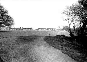
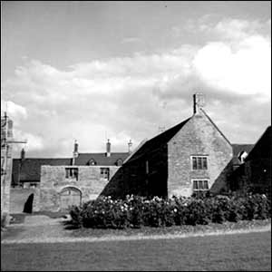
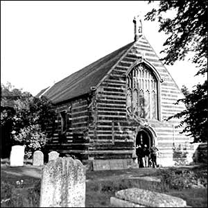
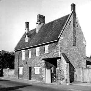
Built in layers of light and dark stone, Chichele’s Bede House has long ceased to hold the twelve poor men and their woman attendant for whose comfort it was bestowed round about 1423. Soime of the old lockers remain, the impressive roof has been preserved and the fireplace is the original one. Extensive repairs were made to the Bede House in 1956. The Bedesmen of olden times did not get the advantage of living in an alms house without giving something in return and according to the regulations they were perhaps too often at church or praying for their benefactor. Something brighter would be demanded today, even in tradition loving Higham Ferrers. Bedesmen, however, are still elected and a Bedeswoman still prepares meals for them on St Thomas’s day when they go to church and smoke their pipes in the town hall. They are all veterans nowadays and their grant is at the old rate of one penny per day with an occasional red starred overcoat and extras at Christmas.
|
||||||||||||||||||||||||||||||||||||||||||||||||||||||||||||||||||||||||||||||||||||||||||||||||||||||||||||
|
More Historical Monuments
|
||||||||||||||||||||||||||||||||||||||||||||||||||||||||||||||||||||||||||||||||||||||||||||||||||||||||||||
|
||||||||||||||||||||||||||||||||||||||||||||||||||||||||||||||||||||||||||||||||||||||||||||||||||||||||||||
|
||||||||||||||||||||||||||||||||||||||||||||||||||||||||||||||||||||||||||||||||||||||||||||||||||||||||||||
|
||||||||||||||||||||||||||||||||||||||||||||||||||||||||||||||||||||||||||||||||||||||||||||||||||||||||||||