|
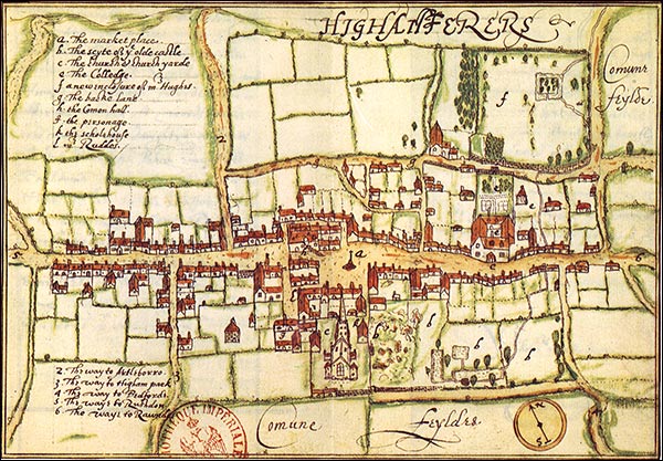
This picture is taken from a greetings card. The street plan was drawn in 1591, by John Norden and was included in his 'Speculum Northamtoniae' which was the earliest topographical survey done of an English county. A detailed explanation of the plan is in Maurice Beresford's 'History on the ground'. The plan is held at the 'Bibliotheque Nationale, Paris'.
|